

Placemaking Event
When
From 14 September 2020 to 30 November 2020
Where
L'Hospitalet del Llobregat (Spain)
Posted
19 November 2021
Category
Photography


Third-year students of the subject Systems of Representation (SDR) carried out a photographic survey of the cityscape. The work was carried out in three stages:
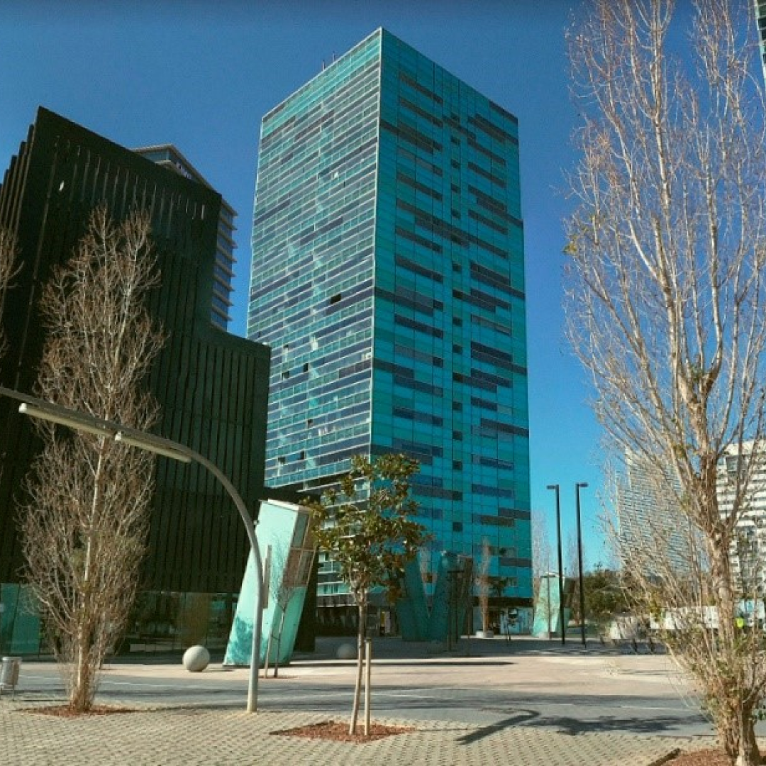
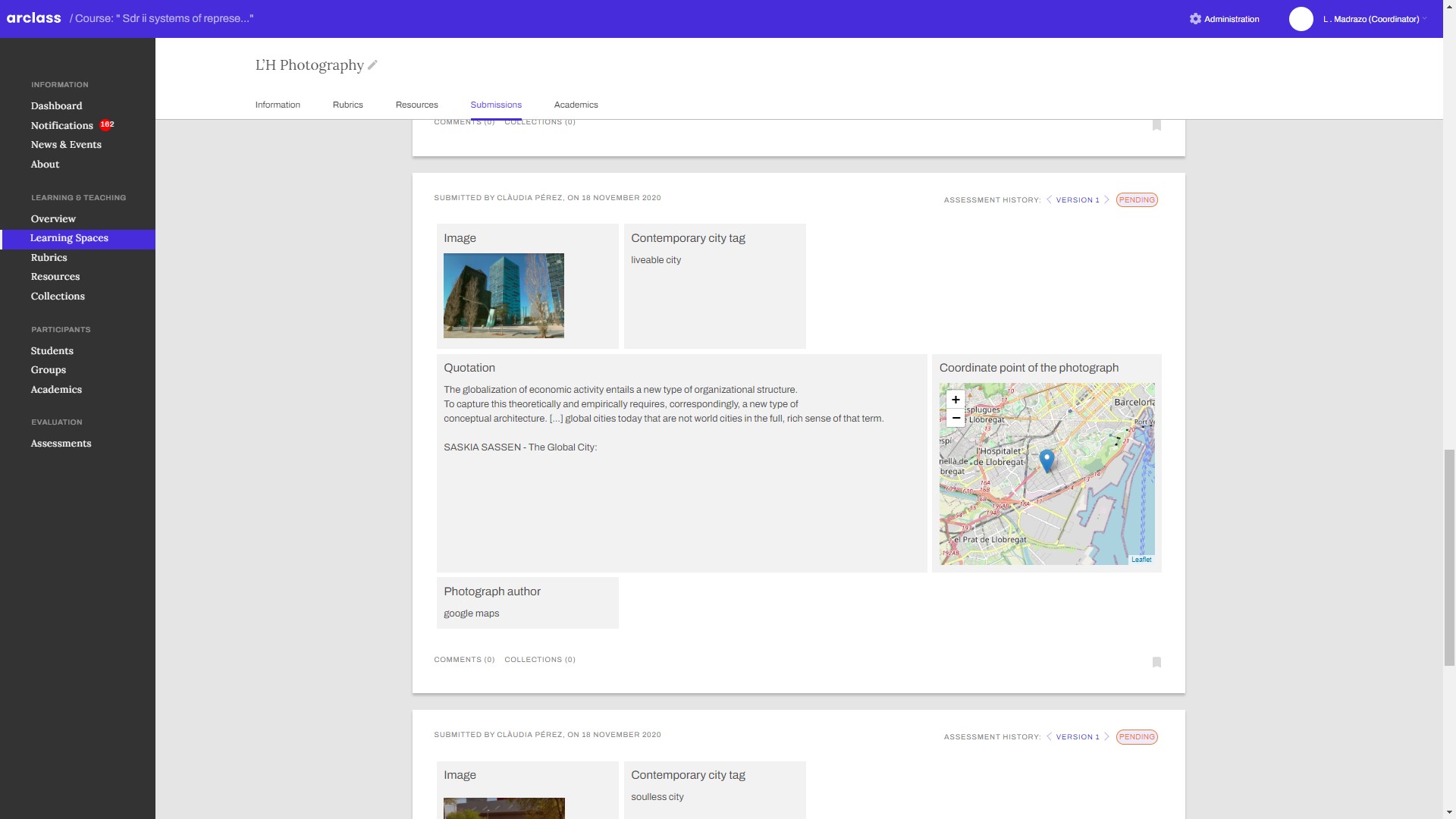
1. Photographing L'H. Taking photographs of the city and relating them to readings on four visions of the contemporary city (generic, metabolic, soulless and liveable city). A collection of photographs was created in the ARCLASS learning environment, geolocated and with the references to the readings.
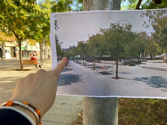
2. Weaving places. Relate one photograph to another taken by other students, and explain the relationships between the different areas of the city depicted in the photographs. The aim of the task was to weave together fragments of the city through the photographs.
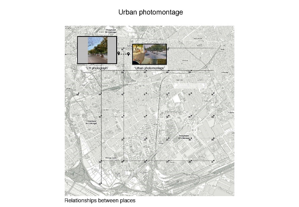
3. Urban photomontage. Placing a photograph taken by another student and a concept associated with it in the urban setting and making a new photograph. The aim of the task was to capture the multiple dimensions of the urban environment (social, spatial, aesthetic) and the multiple relationships between various fragments of the city in a photographic image.
Other files:


Links
Contact
Prof. Leandro Madrazo (leandro.madrazo@salle.url.edu)
Participants
Students and faculty of the Systems of Representation course, School of Architecture La Salle, 2020/21